Anza-Borrego Desert State Park, December 12-16, 2012
When its grey in Oregon....go to the desert!

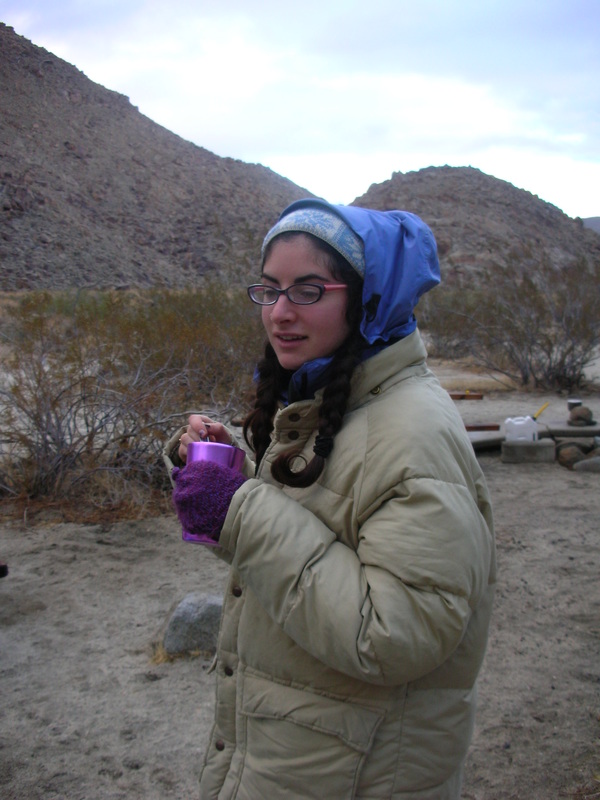
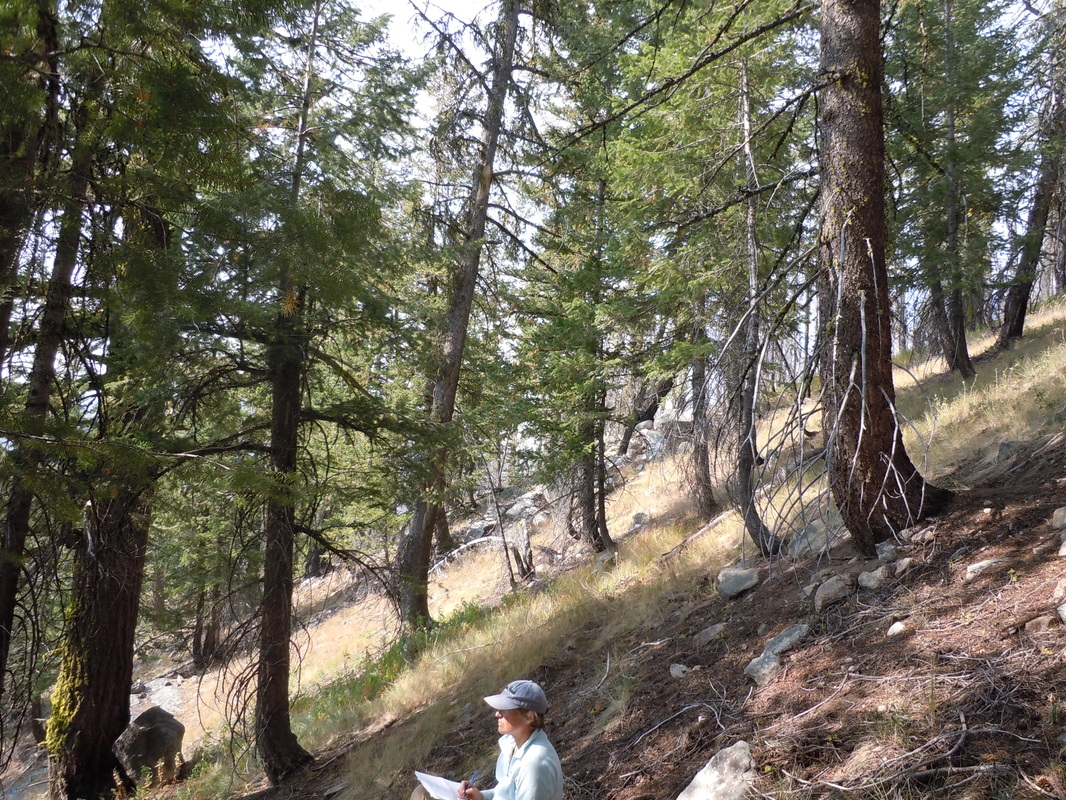
Happy reaction of Reva and Peter to the sun and desert sights.
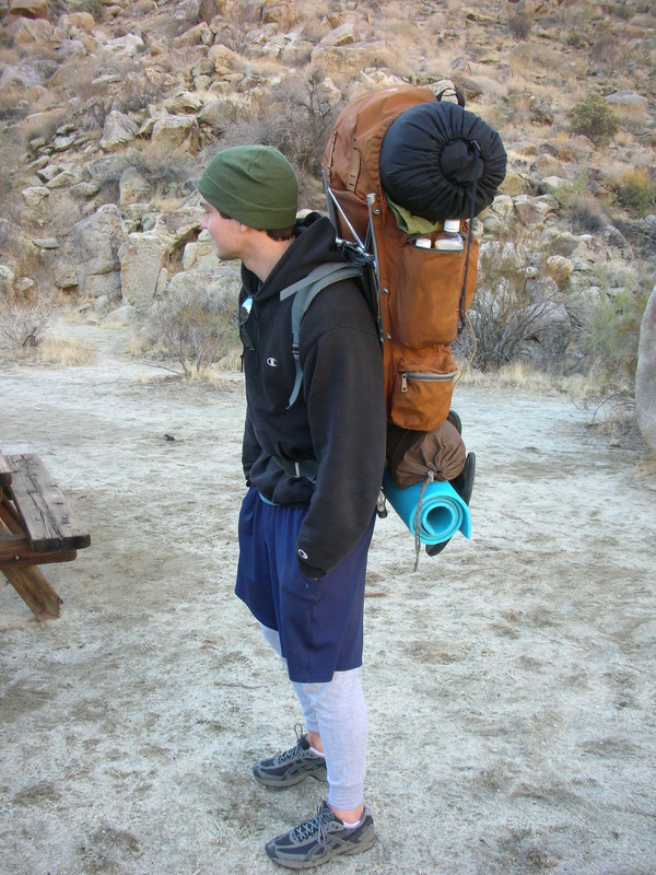
About now, the continuous cloud cover and cold drizzle are getting all too familiar in our temperate rainforest home.. What better place for sun and warmth than southern California—and what better place for a desert wilderness experience than Anza-Borrego State Park! Six hundred thousand acres of pristine Colorado Desert (the western extreme of the Sonoran Desert), this jewel of the California State Park system lies just east and northeast of San Diego. On December 12, Reva and Peter and I made the drive from Paso Robles, hoisted our backpacks, and hiked in to see what we could see.
Road's end.
We began our trip with the decision to leave our truck parked BEFORE the second crossing of Coyote Creek. Although our instant weekend jeep friends merrily encouraged us to give it a try—it was obvious that the water depth would exceed the chasis of our 2WD truck and, (wisely we thought) we chose to walk from here. From Second Crossing we followed Coyote creek to Third Crossing then hiked up a stony road called the Bypass and entered gorgeous Collins Valley. Below the crossing for vehicles (left) vs. hikers (right).


A night of historic suffering

Campsite of Juan Batista de Anza et al. in December 1775
Here
is the view of Collins Valley overlooking Coyote Creek: Juan Batista de Anza from Mexico, and his 280
followers camped right here in December 1775 in this very first overland migration
of European settlers into California. A
freak blizzard struck overnight, killing several horses. A number of the
travelers were saved from freezing by being wrapped in blankets and surrounded
by four campfires. Fortunately for us,
but not surprisingly, 2012 was a bit warmer!
And in the more pleasant present

We found a comfortable camping spot in Collins Vallley near the mouth of Sheep Canyon. It rained every night, but we stayed warm and dry, and our days were always at least partly sunny. One thing about winter camping, it gets dark at 4:30-4:40 PM –making for a long night. After the first night, we learned to collect firewood during our day hike and made a cozy campfire in an iron outdoor grill raised above the ground. Peter kept us from setting the desert on fire by dowsing our ashes when the wind came up late in the evening.


A jeep cavalcade

Frank and Carl and ten or more other guys have a ‘men’s weekend’ here every December. They camp in style, with chairs, tarps, firewood, grill, coolers, lanterns, and generous amounts of food and drink. During the day they leave in a cavalcade—each guy drives his own jeep!—to explore the park by primitive road and when necessary, by foot. They were incredibly nice to us and welcomed us by their fire when it was raining and provided us with bottled and tap water from San Diego and San Marco so we didn’t need to filter the biotic swarm from Sheep or Cougar Canyons—our closest ‘drinking water’ sources.

Jeeps driving up to the bypass
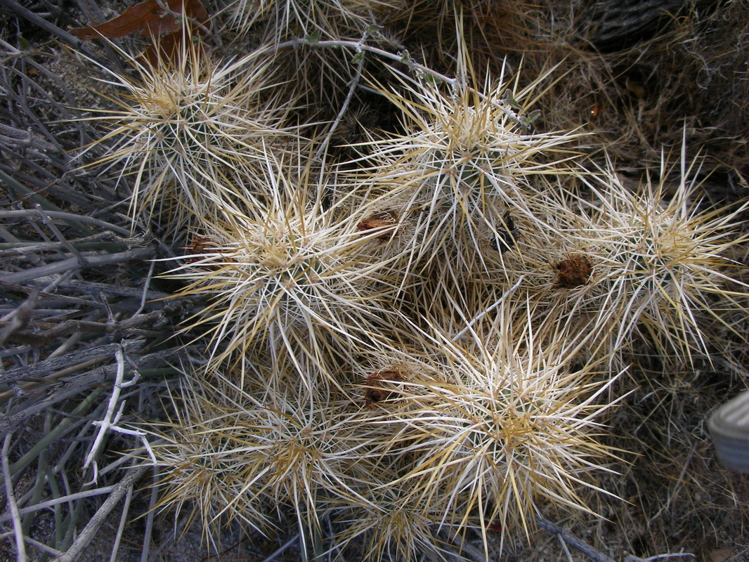
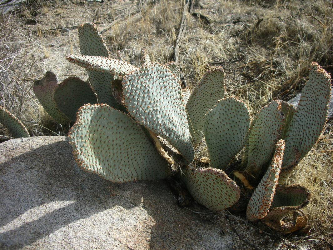
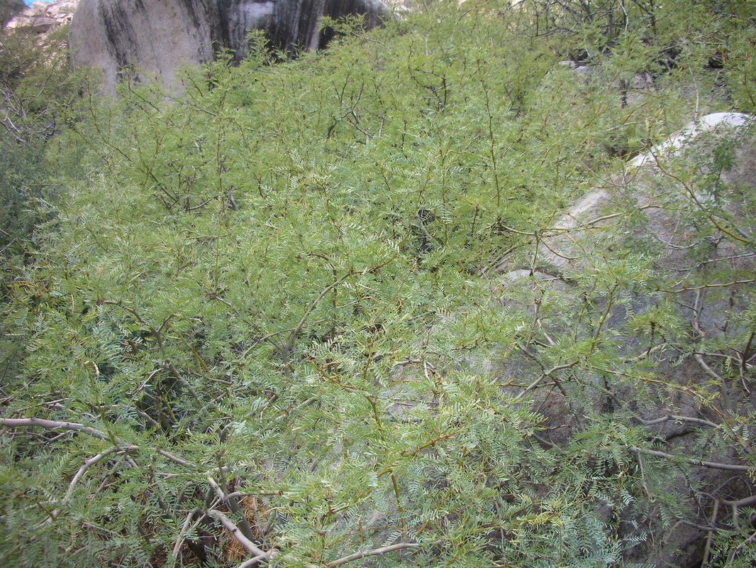
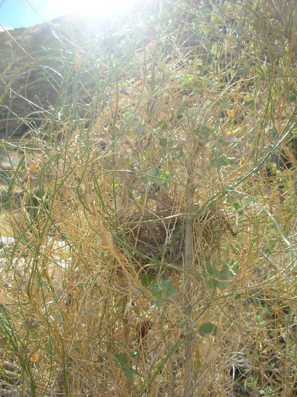
A plethora of plants--thorny ones!

We loved the cacti—they were irresistible photo subjects! (Left) my favorite, golden Cholla (Cylindropuntia) glowing in the morning sun. Among our other favorites (below), small, large and fallen Barrel cactus (Ferrocactus acanthodes), the prickly hedgehog cactus (Echinocereus engelmanii), the pad-like Beavertail cactus (Opuntia basilaris), and Fishhook cactus (Mammillaria dioica) with curvy tipped spines.


Hardy trees and shrubs

To conserve water, Mormon Tea (Ephedra), produces no leaves-- rather the stems are the photosynthetic organs of the plant.
The woody plants displayed an impressive diversity of form. We saw sycamore, juniper, desert willow, mesquite, acacia, creosote bush, and catclaw. Around every corner there was at once an enormous repetition of the same common plants and new plants that we didn’t see before or again. Here the leafless Mormon’s tea, parasitic Mistletoe, salt bush, Juniiper, Sycamore, honey mesquite, the nearly leafless Chuparos, a leafless purple stemmed acacia-like shrub, and a mistletoe that has become nearly as large as the host mesquite bush that is killing.


Agape at Agave

The flowering stalk of the century plant (Agave desertii) dwarfs Reva. Contrary to its name, this plant typically lives 10-12 years, flowers then dies. It is endemic to the Colorado Desert.
Flowers!

The best time to come to Anza Borrego for flowers is March, but blooms occur all year long. We saw California fuschcia, buckwheat, dodder, ocotillio and white sage in flower or fruit.


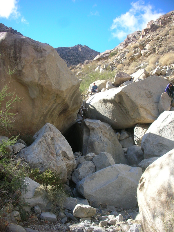
Bouldering Cougar Canyon

A fun time exploring and a total workout.


1) JOHN MUIR WILDERESS, August 18-22
SUMMER 2012
John Muir Wilderness (Inyo National Forest)

August 21, 2012. The John Muir is one of the largest wilderness areas of the Sierras, encompassing parts of the Sierra NF, Inyo NF and Yosemite National Park. We took a three day trip to explore the wilderness from the west and east sides of the Sierra Nevada, starting at Florence Lake at about 8,000 ft in the Sierra National Forest. These are my companions, Ricardo and Don, from the Forest Service air program, standing here next to one the passive monitors for ozone, nitric acid, nitrogen oxides and ammonia that they maintain at Paiute pass. These two don't look like brothers but they certainly could be. When traveling with them, prepare yourself to listen to an endless low volume, good natured banter-- as they cycle about once an hour through each of their favorite conversation topics: air quality and how to measure it, cars (especially wheel rims), general gossip, Dr. Mercola and how to live a healthy lifestyle, advice to each other, and complaining about each other. In just a few days, they attuned their eyes to finding lichens. Behind them, some of the richest lichen habitat we saw during our trek.

The two brothers, 'The Trail is Flat Cisneros' and 'Swashbuckle Schweitzer'
Rock Frog

Our target lichen here is Xanthoparmelia cumberlandia, also known as Rock Frog from its yellow green color and orbicular shape, usually perched on boulders. Pauite Pass is 11,400 feet above sea level, and this lichen likes its just fine here. We finally found it as we dropped over the pass onto the west facing side-- apparently it requires just a bit more moisture than our other target lichen, Rhizoplaca melanophthalma. Ricardo says that low hanging clouds from the west crowd up to the peak, but do not drop over on the east side. That cloud water, or perhaps the extra snow, provides the minimum moisture required for this 'amphibious' lichen. Even so, it was mostly growing in between rocks, close to the soil, rather than on its usually bouldertop 'perches'. Notice my puffy hands: hanging out at this elevation, though closer to God and a joy for the spirit, was not comfortable for the body! Mine just wanted to get back down the hill.
Feeling like Frodo

Pauite Pass, looking east
I worried for weeks in advance about our hike today, which Ricardo told me would be ten miles long at 10,000-11,000 feet BUT WOULD BE FLAT. I trained by making long walks in Corvallis and Paso Robles, though I never seemed to find time to go more than 6 miles on any one day. When we arrived at the trail head at White Lake, 30 minutes from Bishop, CA on the eastern flank of the Sierras, our elevation was 9,000 feet but, suspiciously, the sign said that the pass was at 11,400 feet.
Me: 'Ricardo, I thought you said this trail was flat?'
R: 'Well if you add the uphill going there to the downhill coming back, it averages to zero.'
I will say one thing, the air was thin but the scenery was beautiful. Ricardo says it reminds him of scenes from the New Zealand mountains in Lord of the Rings. Luckily on all our hikes, we did find the lichens they need to do their study, so all the preparation paid off. They are already finding the wolf lichen and the rock frog before I do as we walk down the trail, so I feel confident that they will be able to sample most anyplace they want to in the Wilderness.

Trail to Pauite Pass from White Lake

Pauite Pass, looking west
Dining in Bishop, California

August 20, 2012. The sign across the street said 'Gourmet Chinese Food'. The one on our side said 'Chinese Buffet' and had a neon fish in the window. Undecided, Don and I followed Ricardo, who thought the fish picture looked promising. In the restaurant, the daily banter stopped abruptly and it became strangely quiet. As the silence continued, I looked across at Don and Ricardo thinking something must be amiss. I summoned my courage to gently ask, 'Is something wrong?' Ricardo looked at me as though the answer were obvious, 'We are eating' he said.
John Muir Wilderness (Sierra National Forest)

August 19, 2012. Florence Lake. Starting at Florence Lake at ~7500 feet you can hike all the way to Paiute Pass at 11,400 feet, then drop down the east side of the Sierras to White Lake campground, only 30 minutes drive from Bishop, CA. The whole trail is 32 miles and all of it with magnificent views of glaciated valleys, mountains, lakes and forests. The white granite with black dioritic flecks and the blue color of the lakes reflecting the clear sky, make it all look clean and fresh.
Wolf lichen and old juniper

Don and Ricardo want to know if and where air pollution is a problem in the John Muir Wilderness-- they are not only interested in particulate matter created by forest fire dangerous to humans, but also in pollutants that originate from emissions sources off national forest lands-- from fossil fuel combustion and food production. The emissions are nitrogen oxides and ammonia. Ozone and nitric acid, nitrates, and ammonium ions all form in the atmosphere as secondary pollutants and are deposit to vegetation in rainfall and dry deposition of particulates, vapors and gases. They act to overfertilize and acidify the environment, resulting in shifts in biotic communities (diatoms, mycorrhizae, mosses, lichens, understory plants) that favor weedy, nitrophytic species. We can use lichens to estimate nitrogen deposition on the landscape because we have calibrated lichens with on site measurements of deposition. The fluorescent yellow wolf lichen, Letharia vulpina, is one lichen we have used a lot because it is widely distributed, easy to identify, and fairly tolerant to air pollution. In the John Muir forest it grows on the oldest Juniper trees, between 7,000 and 9,000 feet.

In Sierra National Forest, search for the wolf lichen on the oldest juniper trees.
2) SAN JACINTO MOUNTAINS, CALIFORNA August 23-25, 2012
A Desert Ditty

August 25, 2012. Palm Springs, CA. Here in the airport after 3 days of lichenizing in the San Jacinto Mountains, soothing music plays and it is cool. Mitzi, a young climber/botanist from Joshua Tree National Park, dropped me off on her way back from our mountain lichen workshop. Just yesterday we were at 7,700 feet at the top of Black Mountain enjoying the views and picking our way from boulder to boulder, eyeball to rock, scrutinizing the colorful lichen flora. Now here, blocked from the cooling Pacific Ocean, low down in the desert, it is broiling outside, well over 100 degrees. I lasted about 10 minutes, long enough to document the elegant row of palms and rows of flowers and drought-defying fountain outside with our mountain top in the San Jacinto range in the background.

Adversity spawns diversity

Yesterday, we picked our way among the jumping cholla and the prickly padded cacti, enjoying the wild adaptations of the local flora to the desert sun, checking out the lichens on rock. One of our group, Deb, was stabbed through the shoe and then into the foot by a 4 inch thorn; which was painfully extracted by gallant Fletcher, who happened to have brought his Leatherman. We saw a black microfungus that grows on rock under old juniper trees, surviving on the nutrients washed from its needles. We also found a black lichenicolous fungus, growing like a fine web over one of the dominant desert crustose lichens: bright, lemon yellow Acarospora. Nearly invisible to the naked eye, this secretive hitchiker sits on top of its lichen host and takes whatever nutrients it can.
Jumping cholla!

You might want to touch the fuzzy looking plant in the foreground (left), but if you do, a little round piece of the plant will jump from the mother plant and stick into your hand in 25 places-- each recurved spine, a tiny fish hook, stubbornly lodged in your skin. If you shake your hand to get rid of it, more spines will stick into you. Only patient, painful tweezering will remove the spines and separate you from this cactus.
Would you like to live here?

So I was astounded to be shown the entrance of a desert rat's nest-- impossibly guarded by a pile of jumping cholla pieces. How does this rat ever get into and out of its house?
View of the Los Angeles Basin from the San Jacinto fire tower

View from the top of Black Mountain in the San Jacinto Range. The Forest Service 'persons' a working fire tower here, its prize feature a fire spotting scope manufactured in the 1930s. It spins on a metal base as big as a sundial and its surface is covered by a topographic map. You look spin the base and then, looking through a view finder, line up the actual fire along a cross-hair made of real horse hair. Then you read the compass direction at the base of the dial and compare it to a list of geographic features corresponding to every few degrees of aspect. A small measuring tape extends from the 'sundial' center (i.e. the fire tower) to the edge, each inch represents 2 miles. Then you radio in with the general geographic location, the aspect, and the distance from the fire tower.

San Jacinto Holy Ponderosa

August 23, 2012. San Jacinto Range, 5600 feet elevation. The University of California maintains a small 60 acre nature reserve, in the San Jacinto Mountains, overlooking the Los Angeles Basin. At 5600 feet elevation, the air is cooled and moistened from the ocean and there is a forest here. The largest Ponderosa Pine in the state of California grows not more than 300 ft from the reserve headquarters. I photographed the incredible athleticism and industry of local woodpeckers, who have peppered the trunks of some of the largest trees from the ground as far up as one can see with holes that look like buckshot.
Wild Forests of Southern California

August 24, UC James San Jacinto Mountains Reserve, CA. Writing from the cozy office at UC James Reserve in the San Jacinto Mountains, the sound of hummingbirds and jays and many little birds I don't recognize swarm the bird feeders outside the office. I've been sleeping in my tiny backpackers tent back aways from these headquarters under some big Jeffrey Pines. Even though we are only an hour from Riverside, there are beautiful stars at night and several kinds of owls that hoot and call to each other in the early, still dark, hours of morning and plenty of singing crickets. Today is a day of walking through the reserve looking at the lichens here and watching Kerry Knudsen's slide show about the variety of lichens in national forests of California. At night, I slip back into the office to work on the climate change white paper or respond to Heather's evolving analyses for our model interpreting patterns of lichen community composition along climate and air quality gradients in eastern OR & WA.
Potato Potahto

Kerry Knudsen is instructing our taxonomy workshop. Like so many lichenologists, he is a bit idiosyncratic-- its hard to get into lichenology through any direct route--but he also has the unpretentious warmth for his students and colleagues and passion for the subject matter that makes lichenologists, in general, fun to be around. And, his knowledge of lichenology is honestly earned-having logged many many miles treking his home mountains of southern and central coastal California, followed by many many hours with his microscope. Becoming a lichenologist was all the harder being that he ran out of macrolichens after his first week of study. Yes, its so dry here that nearly all the lichens are crusts. Kerry carries a 3 pound hammer and a 2 " wide chisel to retrieve pile of rocks for his home lab bench. He's documented hundreds of species in the local area. We learned that lichens here grow in pockets of moister habitats on the landscape-- its not the continous cover we see in western Oregon and Washington where nearly every tree over 80 years old sports its own lichen garden. Kerry showed us how to find and distinguish the dominant genera: Acarospora, Aspicilia, Caloplaca, Candelaria, Candelariella, Lecanora, Lecidea, Rhizocarpon, and many of the less common genera and species. His pronunciation is a bit different-- which he neatly attributes to his slavic wife.
3) A STIKINE RIVER JOURNEY, August 27-Sept 3, 2012
Getting there

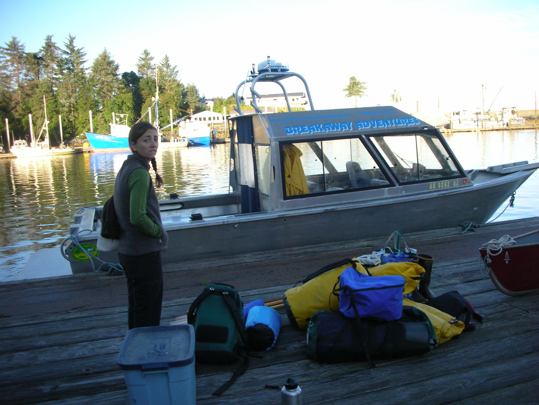
Our journey to Telegraph Creek, 250 km from Wrangell, took one day by jet boat. Here our caravan consisted of two jet boats, 12 persons, 3 canoes, 1 kayak, and one scow on a 90 foot tow line.


Telegraph Creek

27 August 2012. Telegraph Creek, British Columbia
A windy, lonesome place of historic structures succumbing to disrepair. Solidly built log cabins, now uninhabited. The few residents live uphill in the new section of town high on the bluffs above the Stikine River. The graveyard, destination of our evening walk, is up above the historic town. There lie the cherished old ones, each stone bespeaking a tragedy or a final good bye. People left behind are not many: each person lost is a dear cost to the community. White picket gates, photos of the beloved carved into the gravestones. Colorful plastic flower wreaths strewn over the mounded graves. Small solar lights on stakes keep vigil at night. I felt a fearsome oldness, stagnation, harshness and loneliness here surrounded by old memories with so little sign of new dreams or endeavors.
A windy, lonesome place of historic structures succumbing to disrepair. Solidly built log cabins, now uninhabited. The few residents live uphill in the new section of town high on the bluffs above the Stikine River. The graveyard, destination of our evening walk, is up above the historic town. There lie the cherished old ones, each stone bespeaking a tragedy or a final good bye. People left behind are not many: each person lost is a dear cost to the community. White picket gates, photos of the beloved carved into the gravestones. Colorful plastic flower wreaths strewn over the mounded graves. Small solar lights on stakes keep vigil at night. I felt a fearsome oldness, stagnation, harshness and loneliness here surrounded by old memories with so little sign of new dreams or endeavors.
Blast from the past

We came back from our cemetary walk and ducked into the Anglican church. It was dark but F. Thomas found the pump organ and we played some simple tunes, pew-sitting in the dark, head lamps flashing, enveloped in spirit by those who came before us.
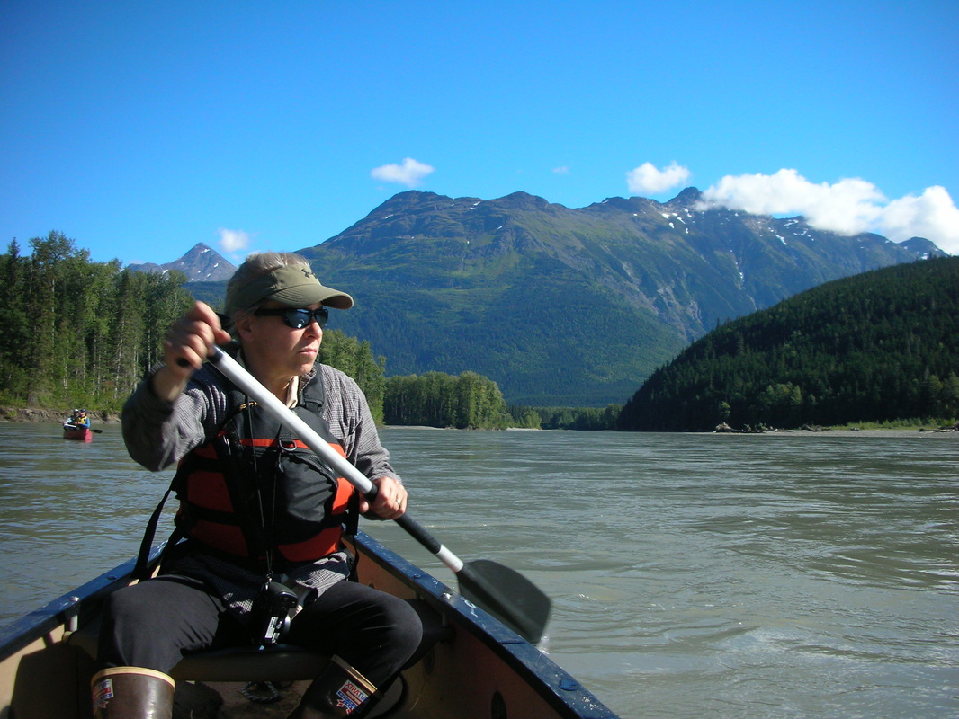
Our boat trip was long but spectacular, loud and vibrational.
Our boat trip was long but spectacular, loud and vibrational.
My companions in adventure

Kitty (Steve in background)

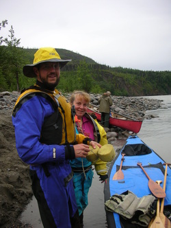
Kate and Father Thomas
'Paddling Machine' Paula

Dave our tireless leader (showing the power of the river to bend plastic fins he designed to stabilize the scow during towing)

Mary Beth (with Mollie and Paula)

MaryBeth and Steve
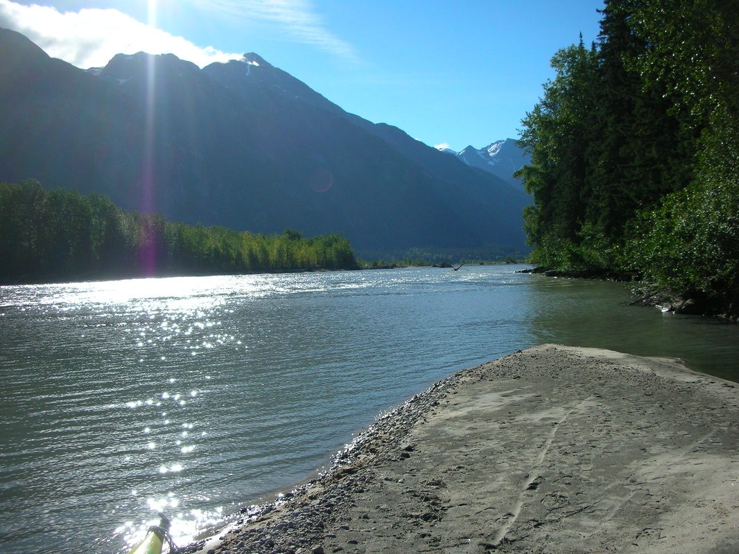
White Sands, Stikine River, British Columbia

Mollie and X relax after a hard days work of pointing from the bow of the scow
29 August, 2012. A happier place of soft, white sand and glacial blue water. We camped along a glacial melt stream intersecting with the Stikine River--a little of Bermuda in SE Alaska.
Our trip today was a constant photo opportunity. The gestalt though is so much more than any photo: the smell of cottonwood, sweet yet pungent and medicinal, flavors the fresh air. The warmth of the sun on bare skin. The unexpected sound of sand grains mixed by the current sweeping along the bottom of the canoe-- the tinkling sound loudest where the river churns, upwells, and mixes itself in swirling circles. F. Thomas says the sound is not from sand grains hitting the boats but the sound of sand grains lifted and rolling along the river bottom, amplified by the hulls of the canoes.
Our trip today was a constant photo opportunity. The gestalt though is so much more than any photo: the smell of cottonwood, sweet yet pungent and medicinal, flavors the fresh air. The warmth of the sun on bare skin. The unexpected sound of sand grains mixed by the current sweeping along the bottom of the canoe-- the tinkling sound loudest where the river churns, upwells, and mixes itself in swirling circles. F. Thomas says the sound is not from sand grains hitting the boats but the sound of sand grains lifted and rolling along the river bottom, amplified by the hulls of the canoes.

Camping in style

Our tent village, clustered closely to claim a temporary stake from the bears.

Our food system-- each person has their own tub. At night we move them back to the boat where the dogs sleep and guard them from interested wildlife.
Bill's place

We visited 'Bills' fifty acre or so spread along the s side of the river-- a truck farm and river fishery with numerous cabins, boats, motors, shops, barns, vehicles (trucks, tractors, even a plane). The garden along could feed at least 20 people, maybe 50.


When you are this remote, to make repairs, you need a lot of stuff hanging around.


Jackson's place

Then to the abandoned Jackson's place-- a tumble-down cabin being reclaimed by the forest and shoulder high thimbleberry. We traipsed our way between the high wet thimbleberry (a rose with tasty blueberries) and high bush cranberry to view the river where it smashes into a rock sidewall and passes through a narrows,becoming a scary looking fast-moving sliver of its width above and below.

Scouting and snacking trip through thimbleberry
Dots in the wilderness

No boating incidents so far: all are managing their boats well. The river's chief character? It is fast and vast; we are like floating bugs being swept downstream: insignificant floating sticks. Luckily the river is not flooding and there are no floating trees to contend with or wild raging waters.
A walk to check out the rapids

A brief walk to an overview to survey our first set of rapids.

Its only August but the plants tell us that fall is here...
Nature plays with minerals

Small rocks
The geology here is impressively varied--each river rock appears to have come from a different place in North America.

Tiny rocks

Layered and pressed tiny rocks

Big rocks
Humans play with minerals

We play archeologist and dig and wash out a petroglyph covered rock of unknown age. We are in Tol-Tan territory and the symbols seem authentic. Below the sign marking the site-- which apparently is frequently buried as the free-living, free-flowing Stikine changes its course and sediment loads.

10 paces and x marks the spot
A day of glorious sun

30 August, 2012. Stikine River, BC.
Camping at the confluence of one of the many major tributaries of the Stikine River, mountains surround us as if we were at the bottom of an enormous bowl. The bottom of the bowl is green, lined with tall cottonwoods, the rim is ice covered and snow capped. The wetness of this place is undeniable-- wherever else can one find moss growing on the branch tips of 100-foot tall cottonwoods??
Camping at the confluence of one of the many major tributaries of the Stikine River, mountains surround us as if we were at the bottom of an enormous bowl. The bottom of the bowl is green, lined with tall cottonwoods, the rim is ice covered and snow capped. The wetness of this place is undeniable-- wherever else can one find moss growing on the branch tips of 100-foot tall cottonwoods??
A perfect day

The glaciers bring the feel of SE AK and the flora becomes more familiar. The birch and aspen have dropped outh though we still saw some fir today. Sandy, alluvial soils make for an understory flora more common to drier places.
Today was a picture perfect day of blue skies and 60-70 degree temperatures.
Today was a picture perfect day of blue skies and 60-70 degree temperatures.
Bow to stern

Paula has metamorphosed from a meek, obediant bow to a fully-fledged stern hog. I taught her too many strokes and now she prefers to stern. She's a strong paddler and has the feel for it.
The teams get nicknmaes
Left: Team Gumby, the happy boat with F. Thomas and Kitty
Bottom left: Team Pokey, the fast boat, powered by Kate
Bottom middle: Team Gumby 'at work'
Bottom left: 'The 'Canine Cruiser' rowed and motored by Dave and including the two labs. This team was also affectionately nicknamed 'The Ant' due to its industrious nature (and small body relative the the boat size and oar length) by Team Grasshopper. You can just make out Dave behind the glass window.
Not added yet: Team Water Striders, Mary Beth and Steve--striding along unhurried.
Team Grasshopper, Paula and I. Hopping to the front, but often not knowing the way.


Animal residents

Wolf
Its a comfort having so much human company. Otherwise the wilderness would be more intimidating-- the river more challenging, the wildlife more likely to approach. We see bear, moose, and wolf tracks on nearly every beach. We've also seen fischer and beaver and many bird tracks. We see bald ealges, red tailed hawk, white swans, widgeons, mergansers, teal, and canadian geese. Yesterday a young black bear walked up the beach following its nose and would have checked out our camp but we discouraged it.

Bear

Moose

Goose
What wilderness feels like

31 August, 2012 . Stikine River, B.C.
The Stikine River: the fastest free flowing river in N Am with one of the least densely populated watersheds in N Am.
Sometimes I can't belive it is the year 2012. We have been gone 4 days now and in 3 days of canoeing we have seen only 2 other boats, 1 helicopter, and 1 float plane. We have covered at least 60 miles of river in this time of the most wild and magnificent scenery. We are constantly surrounded by snow capped, glacier tipped mountains with lush green forests of alder, willow, cottonwood, western hemlock and subalpine fir. Tall cottonwood line the valley floor, moss grows right up to the branch tips. On each beach we see bear, moose, wolf, goose, fischer tracks and they are usually fresh. It makes me sick to think of the development the Canadians are planning for this area.

Adrenalin rush

We had a scare today on Team Grasshopper. We went River Right when we should have gone River Left and found a bigger water than we could power through. We almost hit the rock walls-- the close call provided quite the adrenalin surge.
Sick

September 1, 2012. Stikine River, B.C.
I'm sick-- stuffy nose and sinuses, tired, weak. I'm off to bed early, its still light. More paddling today through commanding scenery. Paula has a become a very good stern. She has good boat sense and does not panic in fast water. The river valley is very wide now. As wide as the Columbia River Gorge. We saw 1 boat with 2 people today, otherwise no planes, helicopters or even jets.
Bear, beaver, mosse, woldf, geese around here. We continue to see their tracks are on every beach. We saw two young wolves and a another young bear today; mergansers, bald ealges (mature and juvenile), chickadees, and a bring green toad. Kittly say two seals in the river at 80 miles. No salmon are currently running, perhaps more seals will come up river when they do.
Paula and I had another adrenalin rush today. Dave motored up to give instructions, spoke them and then started to leave. We hailed him because we did not catch all he said and he yelled 'Riveer Left!!!". We said, 'but what else did you say? He said, 'Keep left and turn out on the island. Paulas has been there twice and knows where it is.'
We stayed left but soon the river forked. I said to Paula, 'Which way? Is that the island in the middle?' She said, 'I don't know'. So we stayed left and started down some shallow rapids until Dave made it clear we had gone the wrong way. We pulled to the far left gravel bed and got out of the canoe to figure out how to get back up river. We hauled the boat over the gravel bed to get to a place we could paddle up river and across. On our first try, I got in the bow and the canoe immediately turned back down toward the current. On the second try, Paula got in the stern first to anchor it and then I shoved us off in the right direction and quickly jumped in right in front of her and ran through the boat to the front. That worked, with hard paddling we were able to cross the river without getting sucked down the same rapids.


Our devoted leader

Dave's rowing system: 14 ft oars
Dave does about twice as much work as any single member of our group. He gets up an hour before everyone else and boils water for tea and coffee and for monring dishes. He unloads and loads the boat 4x per day, when we leave in the AM, at lunch, after lunch, and wen we arrive at our campsite. His system is that he and the dogs are the only ones allowed on the boat and he puts stuff on the deck and we haul it away or vice versa. He always does the dinner dishes and often does the breakfast dishes because he is already packed and ready to go while we are still taking down our tents. He did all the organizing of the trip including the accomodations in Telegraph Ck. The scow adds a whole order of magnitude of safety to our journey as he would easily be able to rescue anyone who did spill or flip in the river. Plus, it also carries most of the weight of our materials and supplies including 3 tables, 8 chairs, a propane tank, several coolers, and all the excess stuff most people brought to be comfortable. Dave rows this very heavy boat with a pair of 14' oars, weighted with lead fishing line wrapped around each oar like a wire coil, to balance them. To row, he leans, standing, against a board he mounted at the back of the skiff and, facing downstream, bends forward using nearly his entire body to move the oars through the water. Definitely a manly job!
Dave is truly our guide in the full sense of the word. He helps us navigate our way through the braided river channels and fast water and picks out sights for us to stop and explore each day. He does all of ths unpaid to give us a chance to experience one of N Ams most magnificent unofficial and unprotected wildernesses before the roads, dams, and mines, aready in the works on paper, become a reality.
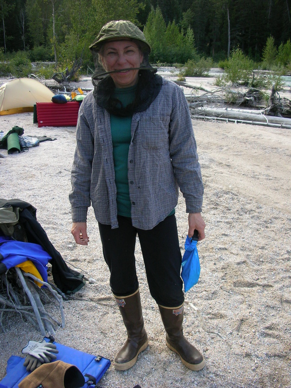
A bug fighter's gallery


Another fine day and visit by the cookie fairy

We had a beautiful sun today, though as we near the US border, we are transitioning from boreal forest to temperate rainforest. We paddled towards the clouds waiting at the border for us all day. It is raining steadily now as I write and I am so grateful for this well-made tent with a fly that goes to the ground 360 degrees around the tent. I am snug and dry and warm. I can hear Thomas and Kate chatting-- they have really enjoyed each other's company on this trip.
To warn bears of our presence as we hiked the 25 minute trail along a bear trail to a view of Great Glacier, Thomas kept up a constant monologue in answer to my questions about the history of the catholic church. I am quite curious about his faith as I expected someone more serious and formal, who would perhaps mention God in every sentence. But Thomas is a regular guy. He is playful, joking, and he loves all the latest camping gadgets. A happy expounder and morale builder, he certainly does his share of work (not to mention having brought along 17 pounds of ccookies and banana bread to share!).
To warn bears of our presence as we hiked the 25 minute trail along a bear trail to a view of Great Glacier, Thomas kept up a constant monologue in answer to my questions about the history of the catholic church. I am quite curious about his faith as I expected someone more serious and formal, who would perhaps mention God in every sentence. But Thomas is a regular guy. He is playful, joking, and he loves all the latest camping gadgets. A happy expounder and morale builder, he certainly does his share of work (not to mention having brought along 17 pounds of ccookies and banana bread to share!).

17 pounds of cookies and banana bread makes one a popular travel companion.
Great Glacier

Today Dave hauled us in groups of 3 and 4 across the river from our campsite so we could walk the trail up to Great Glacier. Great Glacier was a beautiful sight-- retreating and deflating in height, but still impressive. Blue icebergs floated in wierd shapes in the lake it makes in front of itself, which runs via a short river into the Stikine River.
Note to self: For trips more than 3 days, bring extra camera battery and memory card.
Note to self: For trips more than 3 days, bring extra camera battery and memory card.
A Fine Fishery

September 2, 2012. Shakes Slough, Stikine River, Alaska.
Rain all day! We toured Great Glacier Seafood company in Canada near the border, with Bob and Selene. They catch about 20,000 fish each year out of the river, and make caviar and fresh and flash frozen fish deliveries to fine restaurants in Boston and elsewhere. They can flash freeze 12,000 pounds of fish in about 12 hours. Nearly all their power comes from hydroelectric energy that they produce themselves from a generator they rescued from a Seattle junk yard. In summer, they have up to 30 employees, mainly college students from all over Canada. Lots of boats today, from Bob and Bills' outfits; there was a noon opening for coho salmon. Bob and Bill are competitors and we meet fishermen from both outfits. Two of them gave us a fresh, live coho they caught wille setting the net. Paula gutted it at lunch time and Dave stored it in our cooler in a cabinet of the boat between the floor and the hull.
We ate lunch at the border cabin then after that there was more rain. We slogged down a slough to get to the hot tubs and natural hot springs. We must have paddled about 8 miles in about 2.5 hours before we got to the turn-off on a minor slough to the tubs. By then we were too late and too tired and just proceeded on. Dave had predicted that part of the paddle would take us about 45 minutes, but apparently the low level of the river reduced the current speed in the slough. Team Grasshopper got a taste of our own medicine-- the only time that Kate got ahead of us, she passed the turn off to the hotsprings and all our whistling and shouting could not get her attention. When we could not get her attention, we decided to bag the hot tubs and follow her out. Ironically she was so far ahead because, of all of us, she was the one who most wanted to go to the tubs-- but there was no way we would have been able to buck the current in the canoes to go get her and come back. Later we found out she stopped and saw us and would have come back herself had we not proceeded on to meet her at the side slough that she picked out.
Paula cooked up the fish in butterfly fillets, yum, with noodles, parmesan and red peppers and onions. F Thomas spoke about how he became a priest and his beliefs as a catholic.
I think I passed a midpoint in the cold business-- feeling a bit better tonight-- though muscle tired.
Toltec Wisdom: The Four Agreements

I read a book last night from Dave's trove of books saved from burning about the Four Agreements of the Toltecs, a group of early scientists and artisans in pre-Aztec, Mexico:
1) Be impeccable with your words
2) Don't take anything personally
3) Don't make assumptions
4) Always do your best
1) Be impeccable with your words
2) Don't take anything personally
3) Don't make assumptions
4) Always do your best
Back in the USA

September 3, 2012, Shakes Glacier to Wrangell, Alaska
It rained hard all night. Split among two FS cabins a the entrance to Shaeks Slough, we were absolutely comfortable, our wet stuff strewn on shelves, the floor, and hung from a multitude of handy wooden pegs along the beams above. After Paula's feast and F. Thomas' philosopical musings and a good sleep, we packed up all our gear in the rain and pulled out. Mary Beth and Steve Paustian and Kitty LaBounty and I enjoyed a final breakfast together in our cabin. I would be hard pressed to find 3 more agreeable and kind persons for companions and even in close quarters after 8 days of canoeing and camping together their company is still a comfort and a pleasure.
When we left the cabins, the river was as smooth as glass, no wind, low clouds and mists partially obscuring the mountains. Familiar sights paddling the river here-- it is wider and slower but still very powerful judging by the carcasses of entire trees that line the shifting islands and banks of fluvial and windblown sand dunes. In the rain, one cools off faster during rest periods when we stop paddling, but its easy to get too hot when paddling with more than a light layer under the necessary raingear. .F Thomas and Kate and Kitty put their gumby suits back on. There were beautiful, low hanging mists and fogs all day.
When we got to the mudflats, aka 'stumpland', Dave worried that we would get 'scattered like quail' and lost, so he took the lead to guide us through this final maze. We reached the mouth of the river from which we could see Wrangell about 10 miles away.
We paddled toward Wrangell but eventually Dave picked us all up, stowing Kate's kayak over the bow of the scow and towing the 3 canoes, 2 to the side and one behind, and all of us stuffed about amidst the gear piles.


Back in civilization

The rain made it easier to disband and ready ourselves for our return to civilization. Dan and Karen , who came from Petersburg in their skiff to pick me up, followed us into the harbor where we were processed through customs by the most cheerful and smiling official I have ever met. He seem to get a kick from looking us each in the eye and comparing what he saw to our passport photos. Kitty caught the evening jet, just, by scurrying with Paula first back to the Rak's house and then to the airport. Then after getting my left bags at the Rak's house, we all said our good byes.
Photos of Wrangell Island by Noah Sullivan


A Petersburg beach expedition

Mastodia, a lichen of beach rocks resembling seaweed
September 5, Petersburg, AK
Karen and I went out to the end of Mitkof Island on the paved road, hunting for mushrooms, seaweeds, Mastodia, photos of nitrophytic lichens, red huckleberries, and nature stuff (mostly dead flower stalks) for the Petersburg Rain Forest Festival. We stuffed the car with all the goodies and rolled home.
Before coming home we picnicked on the beach. We had bears on our minds, what with a grizzly recently sighted on Mitkof Island, our spying of fresh bear scat, and the teasing warnings of the construction crew where we parked our car. I asked Karen if we should eat a can of smoked sardines I'd been carrying. She gave me a questioning look but didn't say no. So we enjoyed them with our crackers and I sopped up the oil with crackers and then was rinsing the can in the tidewater when we heard rustling the forest behind us. Our attention and heart rates increased immediately and Karen quickly threw all our spreadout stuff in our picnic basket. Just then, we spied a porcupine. We decided to walk back along the beach instead of the woods in case a bear had rustled up the porcupine.
Lichens of Mitkof Island: Seashore nitrophytes, Mastodia, an alga-topped fungus, and Pseudocyphellaria rainierensis


4) PASAYTEN WILDERNESS, WASHINGTON September 10-18, 2012
Team 3

Hannah and I (with Staff Stick) towards the end of our ten day bio-monitoring adventure in Pasayten Wilderness. Team 1 was Amanda and Mike; Team 2: Rory and Joe. Each team worked a different section of the wilderness--we had the most eastern section

Sept 10 Corvallis, Oregon to Omak, Washington
Driving through Mordor between Wenatchee and Okanogan, WA-- 80 grass and forest fires ignited by lightning coalescing on the hillslopes. Live fire shooting into the sky, helicopters with buckets and firefighters deployed to protect structures and put out fires. By early evening dark plumes of smoke were eerily lit orange to red by the setting sun.
We stayed in a hotel in Omak because at 9 PM we were still a few hours from the trailhead.


We try out bivy sacks

Sept 11 Omak to 3 mile on Andrews Ck, Pasayten Wilderness
Hannah and I organized our packs for a 3-day trip in the hotel room where we had lots of room. We studied the maps and determined that Amanda's suggested route was likely more doable than the alternates--so we returned westward via 20 to Twisp then n to Winthrop then n to 20 mile campground and trailhead on Andrew's Ck in Pasayten Wilderness. We hiked 3 miles uphill through fire-killed, standing trees in the Andrews Ck watershed then bivouacked at a good point to walk up to our plot sitting on the ridgetop 2000 feet above us. Even the 3 miles was a good hard walk and we were glad we did not take the alternate route, which involved more miles. There was almost no flat space, it took 45 minutes to find a place flat enough for two bivy sacks. We used our tent footprints as ground cloths and put our bags close together, tied the tops of the bags with ropes to a pole to try to create the illusion of more space and less claustrophobia. We cooked along the side the trail and hung our heavy food sack in a tree near the trail. I threw the rock tied to our hanging rope the first time and the second time-- neither throw went anywhere near the designated tree. Hannah got the rock over in one or two tries, both of us still laughing from my incredibly wild throws. We slept under a billion stars, no moon, the bags surprisingly warm. We saw the milky way and several shooting stars. It was a quiet hike with no animal sounds or signs in the devastated forest all around us. Ceanothus is widespread under the dead tree canopy; there is some regeneration of lodgepole pine, some of the higher slopes look like the soils was burned away.
We had chili for dinner, which sucked up 25 minutes of fuel but was filling.

A rustic kitchen

We hiked six miles to the first live tree in Andrew's Creek watershed
Where's the trail?

An tiny oasis of live trees along Ram Creek near Meadow lake served as our sampling site
Sept 12 3 Mi Andrews Ck to Meadow Lake and return
Feeling less encumbered without packs,we hiked 2 + more miles to the junction of the trail up to Meadow Lake, then another mile during which we made an 1,100 foot climb. That trail had not been cleared out for some time and we only found it about 50% of the time during our climb up, picking our way among the shrubs and fallen trees. Even though we left camp at 9 AM, it was 1:30 before we summitted the saddle--and we still hadn't passed a live tree. We went a little farther and found a riparian stand with enough live trees to do an off-frame plot. The lichen diversity was rich, dominated by horsehair (Bryoria fremontii) and wolf lichen (Letharia vulpina). We whizzed through the plot, then headed back downhill and hiked back to our bivouac camp, arriving 6 PM. We still have not seen much wildlife, but did hear a few birds today. Rice and vegetable dinner ala Hannah--delicious.
Feeling less encumbered without packs,we hiked 2 + more miles to the junction of the trail up to Meadow Lake, then another mile during which we made an 1,100 foot climb. That trail had not been cleared out for some time and we only found it about 50% of the time during our climb up, picking our way among the shrubs and fallen trees. Even though we left camp at 9 AM, it was 1:30 before we summitted the saddle--and we still hadn't passed a live tree. We went a little farther and found a riparian stand with enough live trees to do an off-frame plot. The lichen diversity was rich, dominated by horsehair (Bryoria fremontii) and wolf lichen (Letharia vulpina). We whizzed through the plot, then headed back downhill and hiked back to our bivouac camp, arriving 6 PM. We still have not seen much wildlife, but did hear a few birds today. Rice and vegetable dinner ala Hannah--delicious.

View from 1100 feet above Andrews Ck and tree kill from the 2003 Farewell Fire. We camped on the valley floor.
2000 feet up in 1/2 mile

A precipitous slope: only the cross valley view is visible.
Sept 13 2000 foot climb above Andrews Ck at 3 mi, hikeout to 20-mile campground
A grueling, 2000-foot climb up a very steep slope, leaving camp at 8:30 after a false start to go get extra batteries for the GPS. We picking our way up, hour by hour, in a tight zig zag among the ceanothus. No trees to block a misstep, the entire climb was barely in our comfort zone. We crested the ridge and found live forest but when we got to our plot, every tree was burned. So we put in an off-frame plot about 400 feet from the actual one in a place where nearly all the trees were still alive. Mostly pine (lodgepole and white) and some Doug fir, trees over 100 years. Good diversity, low biomass.
Carefully picking our way,we climbed step by step, back down the slope, arriving in camp by 3:30. We loaded our packs and hiked out to 20 mile campground at the trailhead, arriving about 6:30 PM. A number of hunting parties had arrived with horses. We enjoyed the luxury of a night in our tents, though too tired to make dinner. Temperatures were much warmer at this elevation and I used my sleeping bag as a quilt instead of zipping it.
Our survey site: flattest spot of the day.
Five days backpacking with four days of food

Chewuck R trailhead, Pasayten Wilderness. Smoke from forest fires to the east.
Sept 14 Hike to Tungsten Creek and Chewuck River Jx
We woke up surrounded by forest fire smoke. I found, with delight, that our bear barrel is a perfect container for washing socks and underwear. We packed our backpacks for 4 more plots--taking less with us this time. After much wavering, we decided to bring the bivvy's again to give them an 'honest try'. Looking up the Chewuck R valley towards our destination we saw more smoke; but dispatch did not know of any new fires.
Driving over to 30 mile trailhead on the Chewuck River, we stopped to pay our heartfelt respects at a memorial to four forest fire fighters, all in their 20s who lost their lives in the Farewell Fire in 2003.
The temperature was very warm, close to 80 if not higher, bright sun. I cooled my neck with wet underwear scarves and tied my socks to my pack to dry as I hiked. About 3 miles uptrail we realized with great dismay that we were a full day short on food--having counted plots, not days of hiking in our planning. Food anxiety set in, we discussed how we'd make the food we had brought last, how we'd split up a couple of the dinners to make the fourth dinner. We thought about how hungry we might be in a few days.
A lovely riverside base camp

Our campsite is a lovely spot next to the river with a separate cooking and sleeping area, underlain by pine needles. The kitchen had 3 logs for sitting and two stone tables and a big fire pit.
We cooked Hannah's spaghetti dinner, which was delicious--used up twenty minutes of fuel--another night of incredible stars. A mouse came into our camp and scurried around our food bags, which we promptly cinched.
Sleeping a bit uneasy because of animal anxiety-- the stream was so loud it made it difficut to hear if anything was moving around. A mouse came in the middle of the night and shredded the toilet paper I left beside my bivy. Lots of moose pellets all around our sleeping area. We wondered if the moose would come, or bear, or cougar, or if the mice would climb on our bags. Insects and spiders walked around-- but neither of us could stand the claustrophobia of zipping up the mosquito netting.

The Chewuck River: a scenic watering and washing spot by our campsite

Looks like the river is usually high enough to prevent lichen growth at the base of this rock. Note the moose pellets--there were a lot around our campsite!
A stream runs through it

Sept 15 Hike up Chewuck River
Feeling strong today, we hiked 3.7 miles further up the Chewuck R then about 0.4 miles and 300 feet elevation gain to our plot, crossing the Chewuck R. Very nice walking through boreal forest, with low understory. The plot had a stream running through the middle and we found 3 subplots before we found the center plot, which had almost no live trees due to fire. So we moved the survey center to sampling pt 3, which was in live forest. Loaded with cladonia, pelt lichens, stereocaulon, Solorina, the biggest diversity of lichens occurred on the ground. Many more lichens grew on boulders in the riparian vegetation right along the stream. Back in camp by 6 PM.
Feeling strong today, we hiked 3.7 miles further up the Chewuck R then about 0.4 miles and 300 feet elevation gain to our plot, crossing the Chewuck R. Very nice walking through boreal forest, with low understory. The plot had a stream running through the middle and we found 3 subplots before we found the center plot, which had almost no live trees due to fire. So we moved the survey center to sampling pt 3, which was in live forest. Loaded with cladonia, pelt lichens, stereocaulon, Solorina, the biggest diversity of lichens occurred on the ground. Many more lichens grew on boulders in the riparian vegetation right along the stream. Back in camp by 6 PM.

Strikingly yellow, often split, with polymorphic cups, Cladonia sulphurina, is a common boreal forest lichen in the Chewuck watershed.

We loved our northern forest hike on this crisp fall day. Some common lichens included the chartreuse wolf lichen, a cyanobacterial & unstratified dark Collema, an umbilicate Dermatocarpon, a rosette forming Physcia, and one of the orange lichens, Xanthoria


Tungsten Creek

Sept 16 Hike up Tungsten Creek
We made a ten-mile, round-trip hike up Tungsten Creek to a plot on a north-facing slope.
We walked all day through boreal forest of lodgepole pine, subalpine fir, and Engelman's spruce with low bush blueberry, bryophytes, and lichen ground cover. We heard a chorus of frogs as we were hiking past a wetland. We found a red balloon with its ribbon tie string sitting randomly on the forest floor, seemingly having come to die in the Pasayten Wilderness. Tied to a pack, it, together with our hat, pack and walking stick flagging, gave a festive, fun feeling to our fall trek through the boreal forest, lightening our physical and mental load. Gray capped chickaddees entertained us with their chirping, giving life to this northern forest.
The site was in an old Engelman's spruce-Subalpine fir stand with an intermittent stream originating from plot center. It was cold on the plot, which was north facing at 6400 ft elevation--we wore our down jackets to stay warm enough while we were working there. We saw a prospector's pit and a rusty old Hills Bros Coffee billy can and metal pry bar on the plot. It was on a steep slope, brushy with Rhododendron albicaulis and large boulders, about 400 feet in elevation over about .5 mile from the trail, which itself had climbed up about 1300 feet from our base camp. There was a very high cover of many many different lichens on the ground. By 3 PM it was a little too shady to clearly see the lichens in the trees and we were getting cold.
Returning to our base camp, we ate Mexican Volcano for dinner.


Chewuck Hike

Sept 17 Hike up to to Fire Creek
A poor night's sleep (we saw mountain lion scat near our camp before we went to bed) and a cold morning, but no ill effects from the Mexican Volcano, we boiled our breakfast drink and cereal water over the campfire, and climbed about 1100 feet up a steep forested slope on the east side of the Chewuck R about 1/2 mile down the 510 trail from our campsite. Although there were a number of large douglas fir, there was very little epiphytic lichen diversity or biomass. Nearly everything on young and old tree alike was Letharia vulpina, L. columbiana, or Nodobryoria abbreviata. There was a set of rock cliffy boulders on upper left quadrant of the plot which were great macrolichen habitat and those collections used up most of the packets.
A poor night's sleep (we saw mountain lion scat near our camp before we went to bed) and a cold morning, but no ill effects from the Mexican Volcano, we boiled our breakfast drink and cereal water over the campfire, and climbed about 1100 feet up a steep forested slope on the east side of the Chewuck R about 1/2 mile down the 510 trail from our campsite. Although there were a number of large douglas fir, there was very little epiphytic lichen diversity or biomass. Nearly everything on young and old tree alike was Letharia vulpina, L. columbiana, or Nodobryoria abbreviata. There was a set of rock cliffy boulders on upper left quadrant of the plot which were great macrolichen habitat and those collections used up most of the packets.

Collecting wolf lichen for elemental analysis

The view from our survey site--of our walk yesterday up Tungsten creek to the old fir/spruce forest at the base of the Larch (yellow trees) topped rounded hill in the distance.
One last night under the stars

We moved camp to position ourselves for a shorter day tomorrow about 2 miles down the 510 trail in an open grassy area near a hunting party horse camp. The open area was surrounded by dead standing trees from the 30 mile fire in 2003. There were horses grazing through the standing dead and fireweed between us in the river, penned in by a natural corral of fallen trees. Karla of Tonasket was the guide with another woman friend, her five year old son, Karla's dad, and four hunters. With all the people around and the quiet our Animal Anxiety was much calmed. We enjoyed the luxurious kitchen area with a big rock ringed fireplace and four logs in a square around it to sit on and two stump tables. Hannah prepared a large bed of coals for cooking our dinner of rice stroganoff with vegetables. The stars were incredible from our bivies in this place. We saw a red, white and blue revolving light near the horizon, which we identified as a possible fire tower the following morning.
Fire Creek

September 18 Fire Creek to Winthrop
We woke up cold, the ground tarps and the leaves of the wild strawberry were frosted. We got up and collected firewood and Hannah made a matchless fire from last night's coals. As the fire burned into coals, we put last night's pot full of water between two rocks in between which we had moved an 8 inch depth of new coals. Then we stuffed our sleeping bags, rolled up air mats and bivy sacs and packed our bags as we waited for the water to boil. A last breakfast in the wilderness, Hannah wore 6 layers of coats and shirts and I wore five. After breakfast we trekked about 1/4 mile each way to get water upriver from the horse camp. We pumped 3 liters of water plus a pot full of water and our two mugs to put out the fire.
As we were leaving camp, the sun finally reached the valley floor and we had a two mile lovely fall hike throught the living forest then into the fire zone with beautiful views of the Chewuck (pronounced chee-watch) river. The plot was a patch of mature doug fir surrounded by fire killed trees on all sides. Only a few hundred feet from the river there was relatively high epiphytic macrolichen diversity, including Alectoria and Bryoria fremontii--moist site indicators. Hannah climbed uphill a ways to sample the bigger trees with higher amounts of Letvul and Bryfre. We ate before and after the plot, trying to stretch out the last of our food while keeping up our energy.
The sun reached full heat by the time we set out on the final 2.7 miles or so down to 30 mile camp. Entirely through the fire kill zone it was a scene of devastation and gradual renewal-- mostlly of shrubs, especially Ceanothus velutinus. Up and down above the river we made that last hike in 1 hr 15 minutes. From there we headed back to 20 mle campground where we saw a wolf investigating the campground, and then to Winthrop where we visited with Peter Neitlich and Linda Hasselbach. Peter said that a few wolves have been sighted in the area and that they are protected, but a local poucher had shot most of the pack before being apprehended.

With Peter, Linda, Eli and Sam in Winthrop
Fires of 2012

Sept 19 Winthrop to Corvallis
Loaded with Cinnamon Twisp, Blueberry Scone, Seed Bar and two loaves of bread, we pulled out of Twisp and head back to Oregon. Smoke from the week of forest and range fires created a general, particulate-laden, asthma-inducing haze from Pateros where we joined Rte 97, through Wenatchee, out to Leavenworth, and across the Wenatchee NF to Ellensburg, Yakima, and all the way to the Columbia River Gorge. In Wenatchee, the haze was so intense that the surrounding hillslopes and mountains were not visible.
Loaded with Cinnamon Twisp, Blueberry Scone, Seed Bar and two loaves of bread, we pulled out of Twisp and head back to Oregon. Smoke from the week of forest and range fires created a general, particulate-laden, asthma-inducing haze from Pateros where we joined Rte 97, through Wenatchee, out to Leavenworth, and across the Wenatchee NF to Ellensburg, Yakima, and all the way to the Columbia River Gorge. In Wenatchee, the haze was so intense that the surrounding hillslopes and mountains were not visible.
Home through the fire gauntlet

Our trip south looked different than our trip north
After we passed through, parts of Rte 97 were closed when the fire jumped the road in the Forest. Since our drive north, extensive acres of range, pasture and orchardlands had burned while structures had been protected.
The return drive through the Gorge was clear, the wind mills have become the most striking part of the central Washington landscape. We stopped at MaryHill State Park again to stretch our legs. Nearly all the campers are in RVs-- perhaps some are escaping the smoke to the north. The park kiosk was unattended again and payment seems to be on the honor system.
Thomas and Hannah happily reunited at their home in Portland, I finished the last bit of the drive to Corvallis where my son Peter and I enjoyed a burrito for dinner and he helped me return and empty the vehicle at the office.
A Stick Story

Me with Bent Flag stick
A Brief History of Linda's Walking Sticks
First stick, Squeeze Stick: Left behind, then picked up on the way back down the trail
Second stick, Smooth Stick: Run over together with squeeze stick by a mountain biker when left as an 'x' in the trail
Third stick, Straight Stick: Left behind on the trail
Fourth stick,Bent Flag stick: Left behind on the trail during compass work
Fifth stick, Staff Stick: Still with us.
